
Mountain ranges in cold parts of the planet have classic, glacier-shaped good looks: sheer pinnacles that rise above U-shaped valleys and round basins called cirques. Some scientists have argued that glaciers limit the height of mountains by shaving off their tops, yet tall, horn-shaped peaks still dot the landscape in cold climates.A new global analysis of peaks suggests that rather than limiting mountain height at high latitudes, glaciers make these peaks pointier and taller.A new global analysis of peaks suggests that rather than limiting mountain height at high latitudes and altitudes, glaciers may make these peaks pointier and taller. By carving out U-shaped valleys, glaciers lighten the load of the mountain range, allowing the scraped-out piece of crust to float higher on Earth’s fluid mantle, like an unloaded boat.
“If you have very steep peaks and large, deep valleys, the load of the mountain range above the sea level is quite low,” said Jörg Robl, a geodynamics modeler at the University of Salzburg in Austria, “so even a thinner crust is sufficient to support very high peaks.”
Balances and Buzz Saws
A mountain’s elevation results from a balancing act between three main factors: tectonic uplift, isostasy, and erosion. Mountain ranges form when tectonic plates collide, forcing the crust to buckle and rise. The weight of accumulated rock causes the area to sink because of isostasy, iceberg-like behavior in which heavier chunks of crust float lower in the mantle than lighter ones. Erosion from water and ice wears away the mountains, counteracting the rise from tectonic forces but also leading to a boost from isostasy.
Since the late 1990s, scientists have debated whether glaciers limit a mountain’s height by shaving off the area above the snowline, a hypothesis called the glacial buzz saw. Others have argued that glaciers shield peaks from erosion, allowing the mountain to grow higher from tectonic forces. “It’s a big and hot and sometimes really brutal debate,” said Robl.

In a new paper in Earth and Planetary Science Letters, Robl and colleagues at the University of Freiburg in Germany and the University of Lausanne in Switzerland performed a global analysis of 16,000 peaks to identify relationships between mountain shape, peak height, crustal thickness, and climate. They report that high, steep peaks occur in heavily glaciated regions, suggesting that these mountains missed the buzz saw.
Robl came up with the idea while mountain climbing at Westliche Zinne, a peak in the Italian Dolomites. “I was sitting on top of it and looking at all the mountain peaks and thought it might be a good idea just to have a look at spatial distribution,” he said.
Global Trends in Glacial Landscaping
Using satellite data from NASA, the team used a novel method to identify all peaks greater than 2.5 kilometers that rise more than 500 meters above the surrounding area. By imagining these peaks as cones and measuring the width of the base, they could determine steepness: The narrower the base of the cone was, the pointier the peak was. The scientists compared the peaks at different latitudes to the thickness of the underlying crust using an existing database of global crustal thickness.
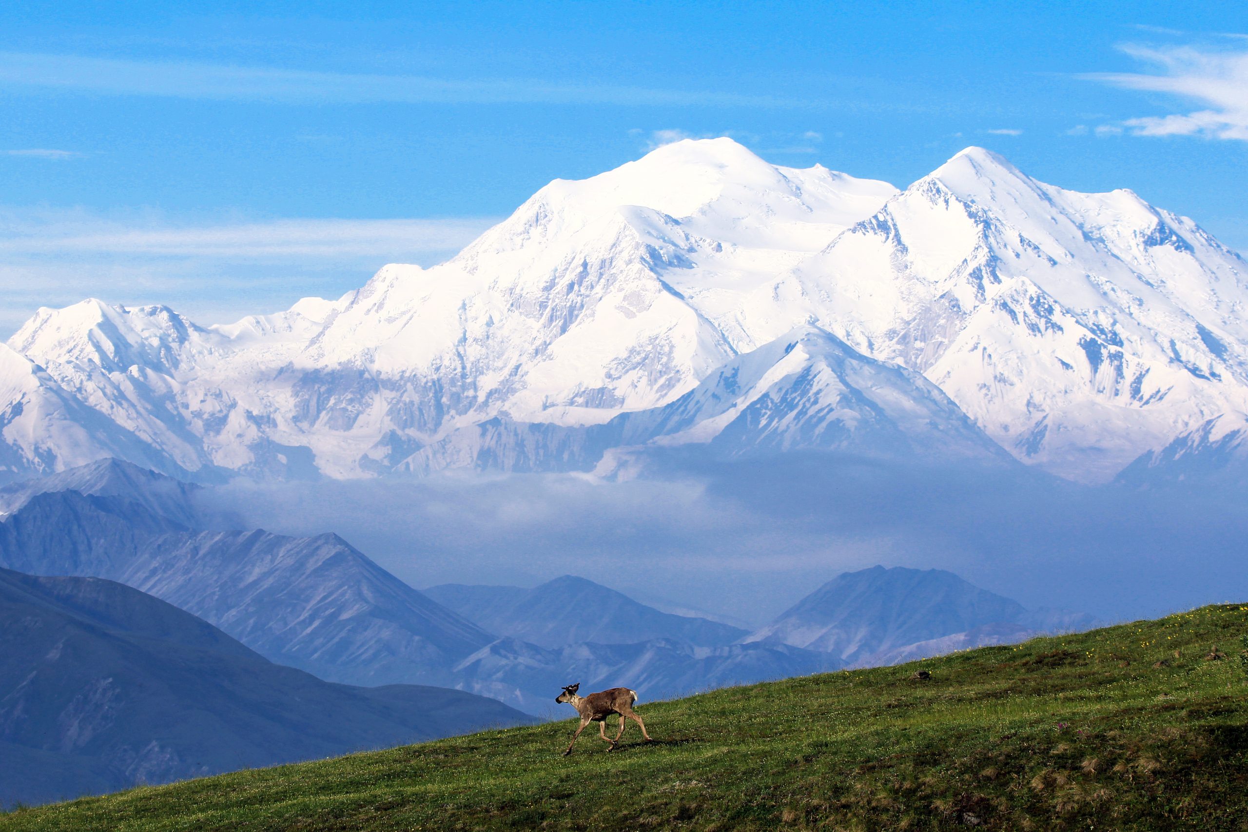
Latitudes near 30°N and 30°S had the tallest peaks supported by the thickest crust, including mountains in the Himalayas and the Andes. Moving from 30° toward 60° latitude, mountain ranges had lower elevations overall but still supported tall, increasingly pointy peaks on thinning crust, such as Denali in the Alaska Range.
High latitudes have cold climates, so the scientists propose that the grinding action of millions of years of glaciers is responsible for the thinner crust underlying these mountains.
.

.
“I think they raised really interesting questions about the relationship between crustal thickness and glaciation—but didn’t answer them,” said Lindsay Schoenbohm, a tectonic geomorphologist at the University of Toronto Mississauga who was not involved in the research. She wants to see evidence on a smaller scale showing the effects of glacial erosion on crust thickness over time to back up these global correlations. Such evidence would be “pretty wild,” she said.“The strength of this approach is its global character, but it’s a controversial study when it tries to link peak climate with latitudinal trends and crustal thickness.”“The strength of this approach is its global character,” said Dirk Scherler, an Earth scientist at the GFZ German Research Centre for Geosciences at Helmholtz Centre Potsdam. “But it’s a controversial study when it tries to link peak climate with latitudinal trends and crustal thickness.” Scherler points out that by lumping mountain peaks together by latitude, the analysis risks overlooking other factors that affect topography and crust thickness, such as tectonic setting.
Now that Robl and his colleagues can model changes in topography driven by isostasy in response to erosion, they are incorporating those changes into their existing model of how mountain ranges evolve. By modeling climate, fluvial erosion from rivers, glacial erosion, and the feedback loops that occur when these processes interact, they hope to understand how these forces have shaped Earth’s stunning peaks.
—Patricia Waldron (@patriciawaldron), Science WriterCitation: Waldron, P. (2020), Cold cuts: Glaciers sculpt steep peaks, Eos, 101,https://doi.org/10.1029/2020EO144232. Published on 20 May 2020.